
Pixel By Pixel Map
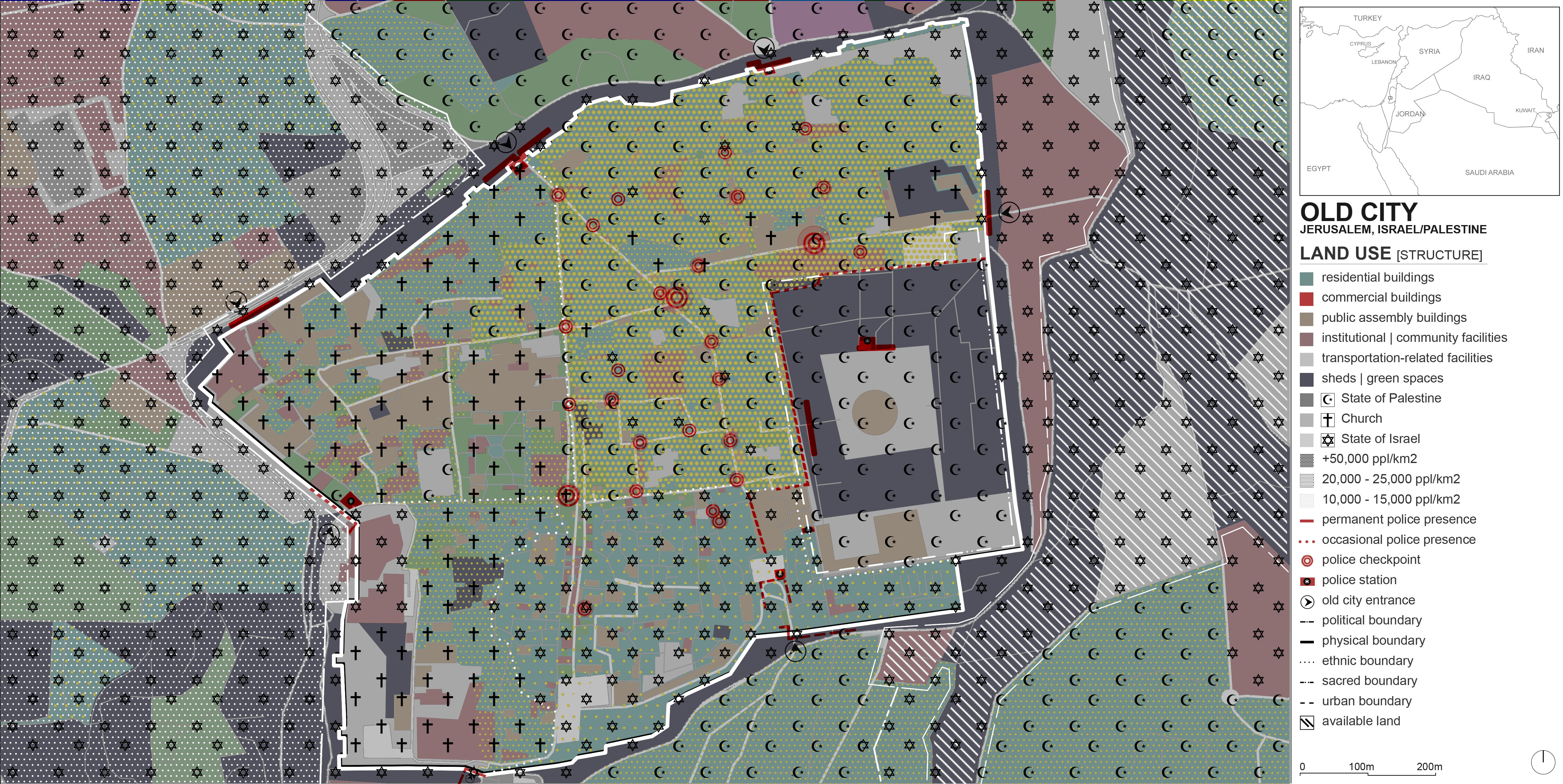
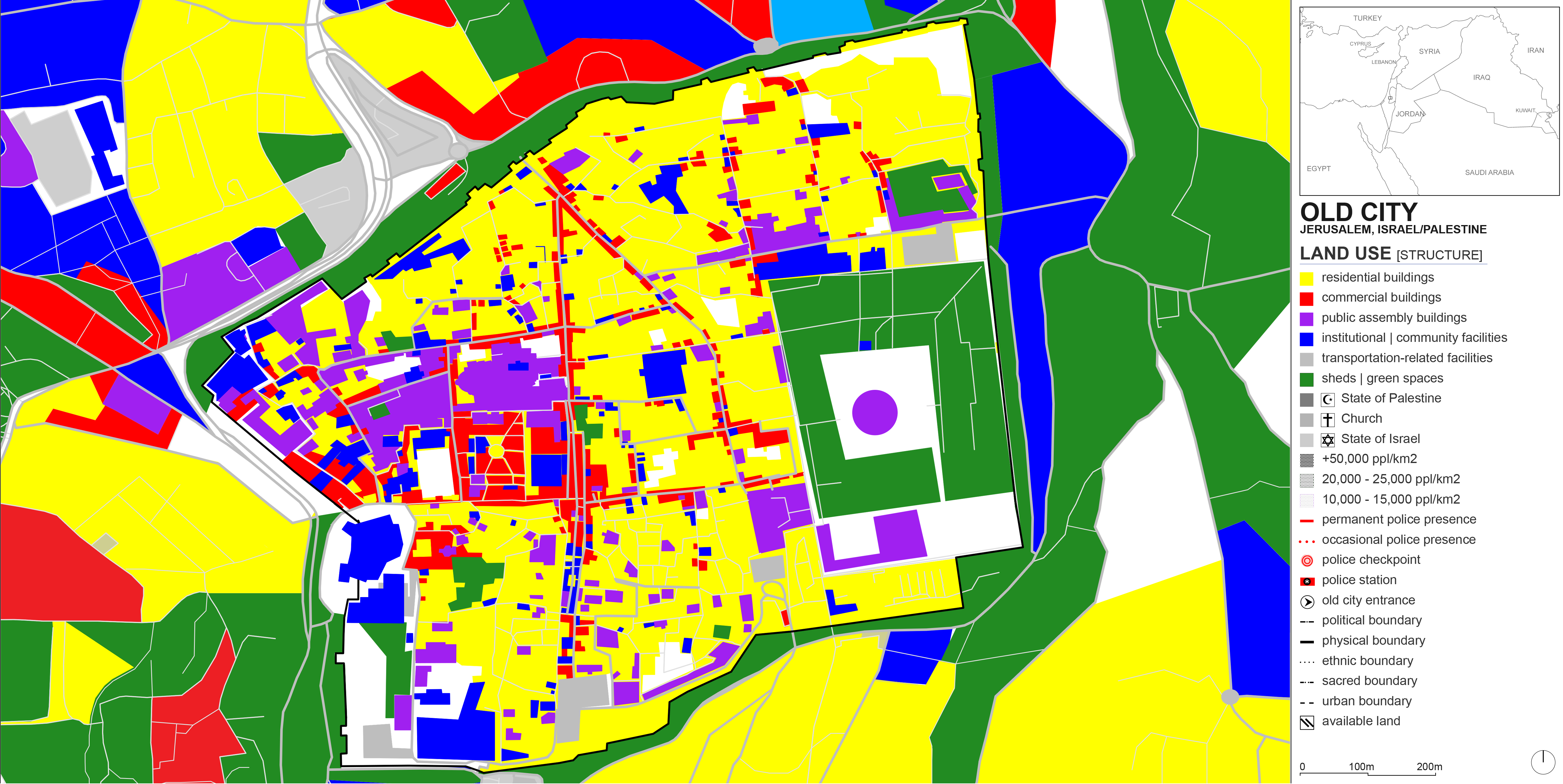

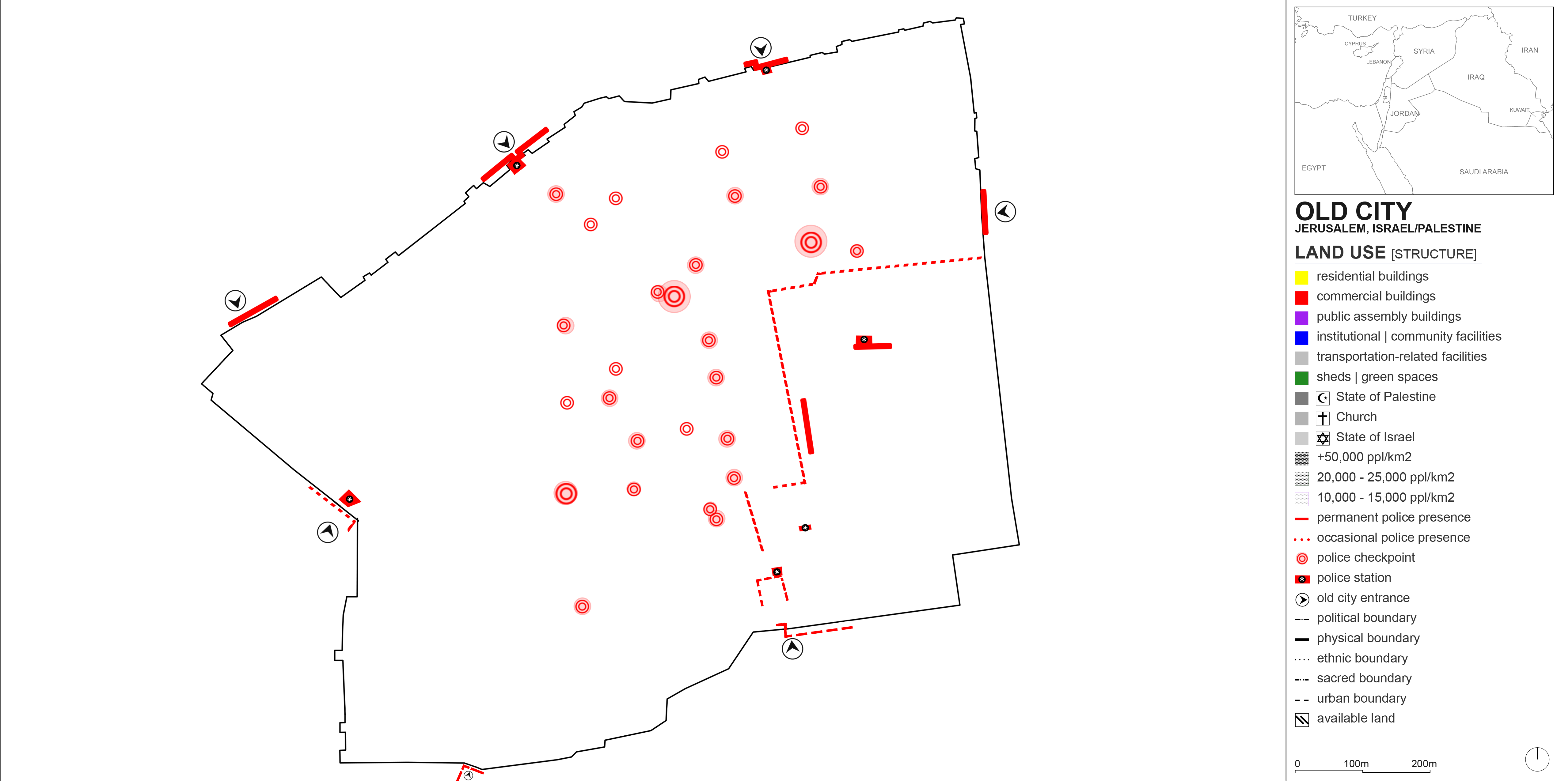
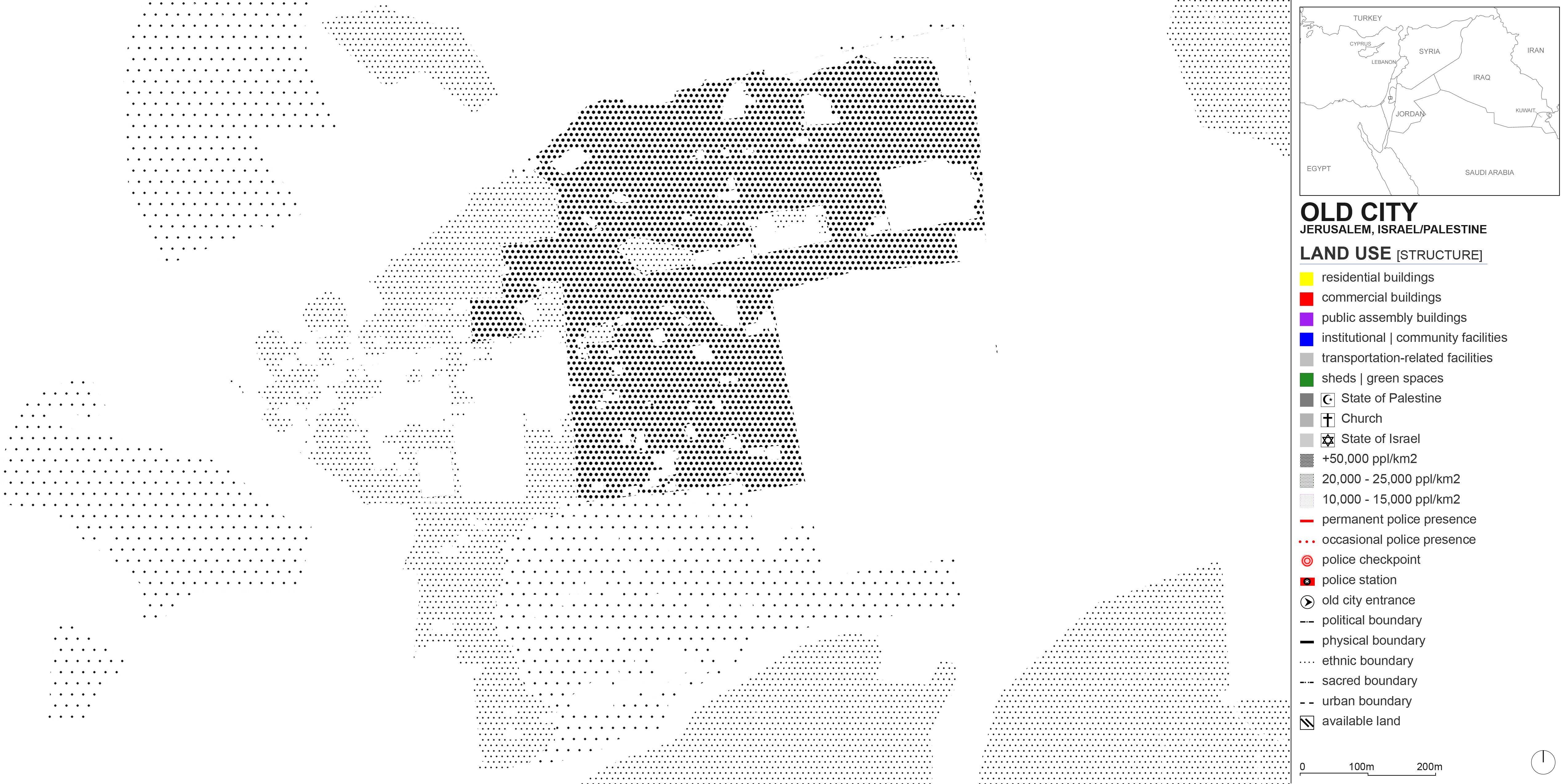
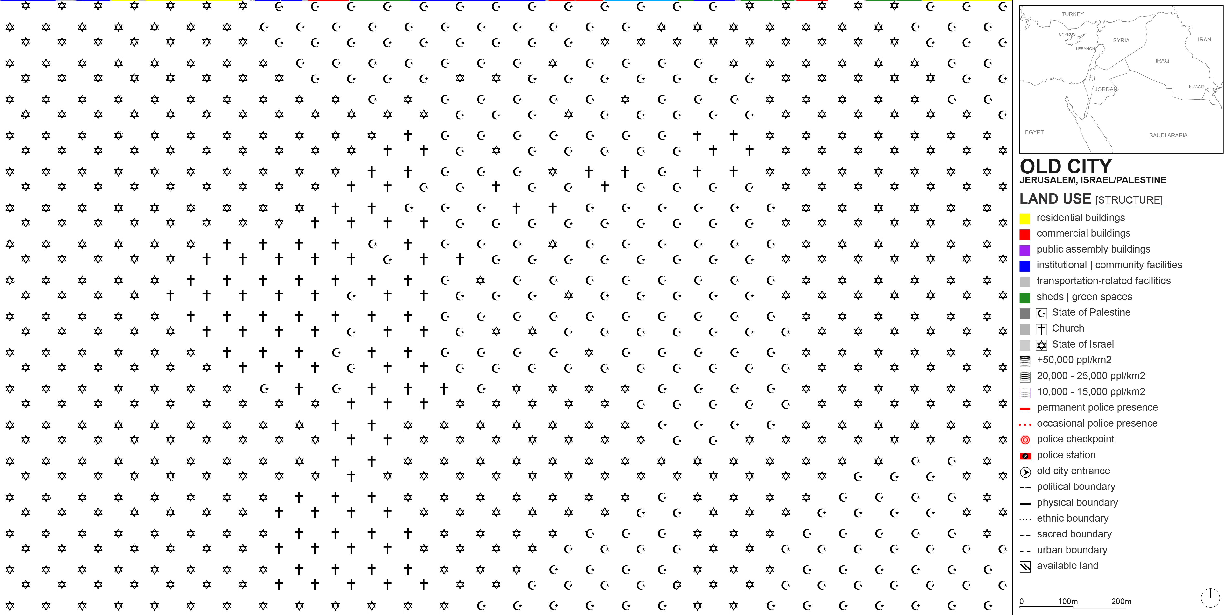
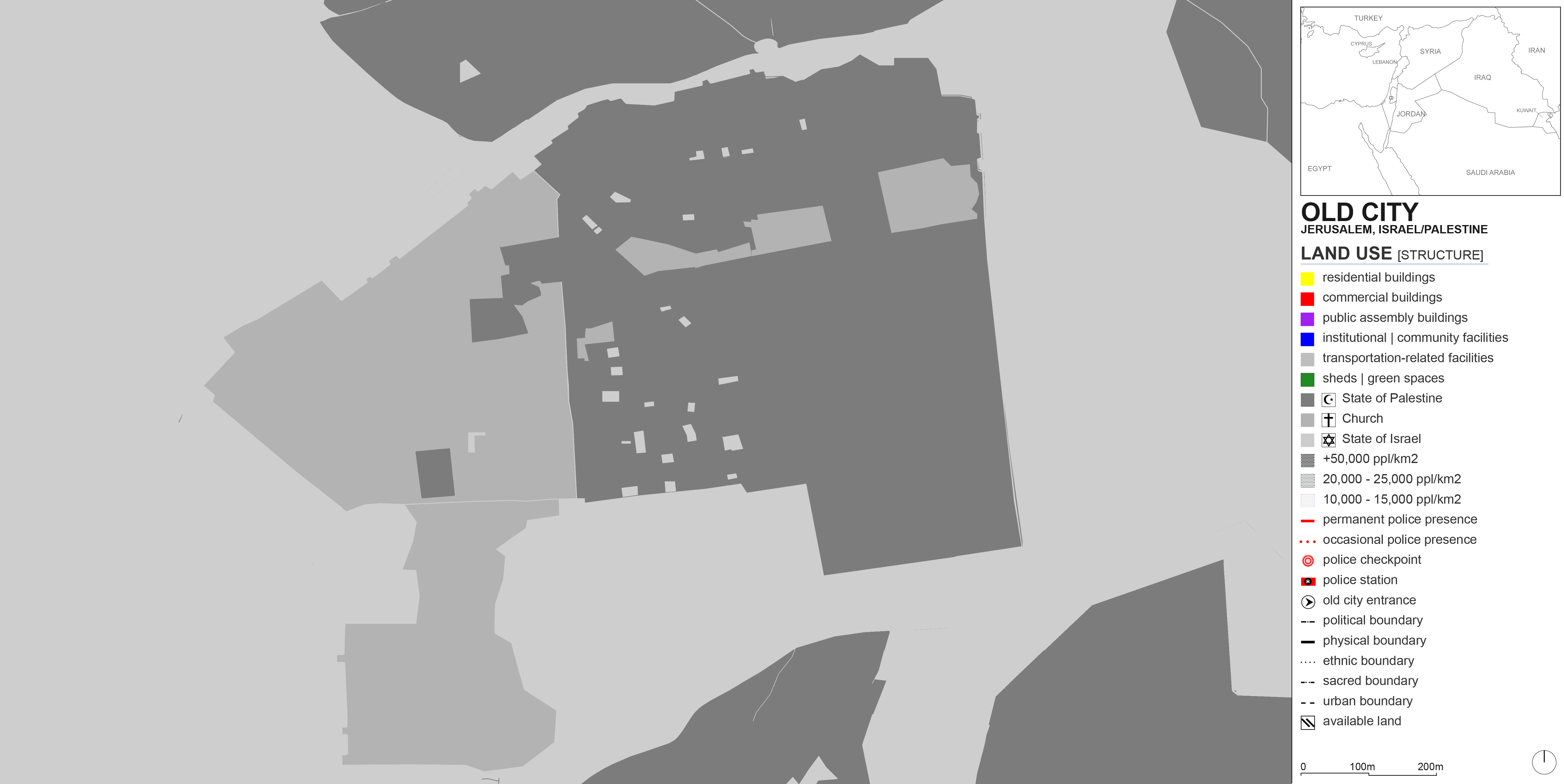
Land use maps are typically made up of color blocks where each color designates a specific use. In the Old City of Jerusalem, it is not possible to simply color entire blocks, because each small parcel of land could simultaneously be a shop, a residence, and a religious establishment – all very tight and compact. The confluence of three religions there and the tense political climate further adds to the complexity of capturing land use. Functions, ethnicities, secular structures, sacred spots, physical boundaries, and political nodes all seep into each other. This is why I resorted to mapping the Old City’s land use (and other data) on a pixel by pixel basis, triangulating sources such as Google Street View, YouTube videos, and documentaries to designate each pixel. For the studio review, I printed the layers on Mylar paper to keep the stacking effect. Here, the layers are simply shown by reducing their transparencies in the first accompanying image. The rest shows the individual layers.